Pages

Showing posts with label Lakes. Show all posts

Sunday, June 19, 2016

Lake Tanuki

On our last road trip in Japan, we visited Shiraito and Otodome Waterfalls in the Fuji Izu Hakone National Park. A little further to the west of Mt Fuji is the Lake Tanuki. 

Lake Tanuki is an artificial lake created in 1935 by diverting the waters of the Shiba River with the intention of creating a reservoir to support irrigation. The lake has a circumference of about 3.3 kms and is 8 meters deep. The lake is now noted for the amazing views of Mount Fuji and in clear weather, the image of Mt Fuji reflected in the lake surface is a well known sight. The lake is a popular vacation spot and has campsites, fishing and boating facilities which attracts tourists from spring to autumn.  

A particular view of Mt Fuji known as the "Diamond Fuji" can be viewed from Lake Tanuki each year between April 20th and August 20th. The sun rising at the top of Mt Fuji gives the impression of a sparkling diamond near the tip of Mt Fuji.


As always the elusive Mt Fuji was partially hidden behind clouds when we visited. But we did manage to click a few pictures when the clouds parted. 

It is a pity we never got to go camping at the Lake Tanuki campsite. I would definitely recommend the campsite for its picturesque location and pleasant temperature.

Address: Shizuoka Prefecture, Fujinomiya city, Saori 634-1

Phone: 0544-27-5240

Campsite Website: Click here  

Sunday, March 06, 2016

Nagoya : Tokugawa-en Garden

Nagoya, an industrial city in Central Japan, is not on every tourist's itinerary when visiting Japan. However Nagoya is well known for a couple of things- its cuisine known as Nagoya Meshi, the hot and humid summer season and its place in history as a former Samurai district. Like Tokyo and Japan, Nagoya is an erstwhile castle town where the feudal lord resided in the Castle and his samurais lived in areas surrounding the castle. For over 200 years, Nagoya was the seat of the Owari branch of the powerful Tokugawa clan. Needless to say, Nagoya does have its share of historical spots that attract a fair share of tourists. 

One such spot in Nagoya is Tokugawa-en, a garden well known for its scenic beauty especially in the colorful seasons of Spring and Autumn. 
The garden was laid out in 1695 AD around the retirement villa of Lord Mitsumoto of the Owari-Tokugawa clan. 
Originally the garden was spread out over 44 hectares of land complete with a large lake, the Ryusenko Lake, in the centre. 
Colorful koi fish swim in the Ryusenko lake.
Some views of Tokugawa-en.


The garden has waterfalls, a tea house, wooden bridge, restaurants and flower beds. 

One of the entrances to the gate is the Kuro-mon gate, the Black gate which dates to early 1900's and is said to have survived the bombings of WWII. A large part of the garden was destroyed in the WWII bombings and was reconstructed to its current form and opened to public only in 2004. 

The garden is said to be spectacular in Spring and Autumn. Various kinds of flowers bloom in the garden through the seasons.  I visited the park with my friends during the Peony festival.  
Many varieties of Peonies were blooming. Peonies. know as Botan in Japanese are seen as a symbol of good fortune, bravery and honor and have been depicted in traditional Japanese art, especially ukiyo-e paintings. Peonies were introduced to Japan from China and have been used in preparing traditional medicines. Perhaps due to these reasons, some varieties of Peonies are known as King of Flowers in Japan.
The flowering pots had an interesting style- a straw canopy covered one side of the pot, perhaps to shield the flowering plants from rain and wind.
Some of the peonies in the park
Plum blossoms were beginning to bloom during our visit.
Also on the grounds of the garden is the Tokugawa Art Museum which houses various exhibits and artifacts such as armors and swords, costumes, masks among other treasures. Visitors can choose to visit both the Garden and the Museum or just one of them. Combination as well as separate facility tickets are available. 

Address: Aichi Prefecture, Nagoya 461-0023, Higashi ku, Tokugawa cho 1001

Opening Hours:  Tokugawa Garden: 9:00-17:30 hrs 
                         Tokugawa Art Museum : 10:00-17:00 hrs

Closed : Every Monday ( following day if public holiday falls on a Monday)
             December 29-31 ; (Museum is closed also between Mid December- early January)

Entrance Fees: Tokugawa en Garden : 300 yen
                       Tokugawa Art Museum : 1200 yen
                       Combination ticket: 1350 yen

Parking: Paid parking available.

Official Website: www.http://www.tokugawaen.city.nagoya.jp/english/index.html    

Friday, September 28, 2012

Fuji Five Lakes

Mount Fuji needs no introduction. It has always been a symbol of Japan till this day remains on every tourist’s list of must visit places in Japan. Mount Fuji’s near perfect conical shape is the result of its multiple eruptions and lava flows.

Mount Fuji’s multiple eruptions have also resulted in the formation of the Fuji Five Lakes, also known as Fuji-go-ko. Fuji Five Lakes is the area located around the base of Mt Fuji’s northern half and is located in Yamanashi Prefecture. In recent years, Fuji Five Lakes which form part of  the Fuji-Hakone Izu National Park, has become a much visited tourist attraction. The lava flows from Mt Fuji’s eruptions dammed rivers and resulted in the formation of these five lakes. All of the lakes are considered to be excellent fishing spots and have been developed into tourist spots atleast to some extent.

The Five Lakes that form part of Fujigoko are Lake Kawaguchi, Lake Yamanaka, Lake Saiko, Lake Motosu and Lake Shoji. All lakes also provide good views of Mt Fuji, on days when the sky is clear and weather is good. Spring and Autumn when the flora and foliage are at their best and most colourful are preferred seasons for visiting Fuji Five Lakes.

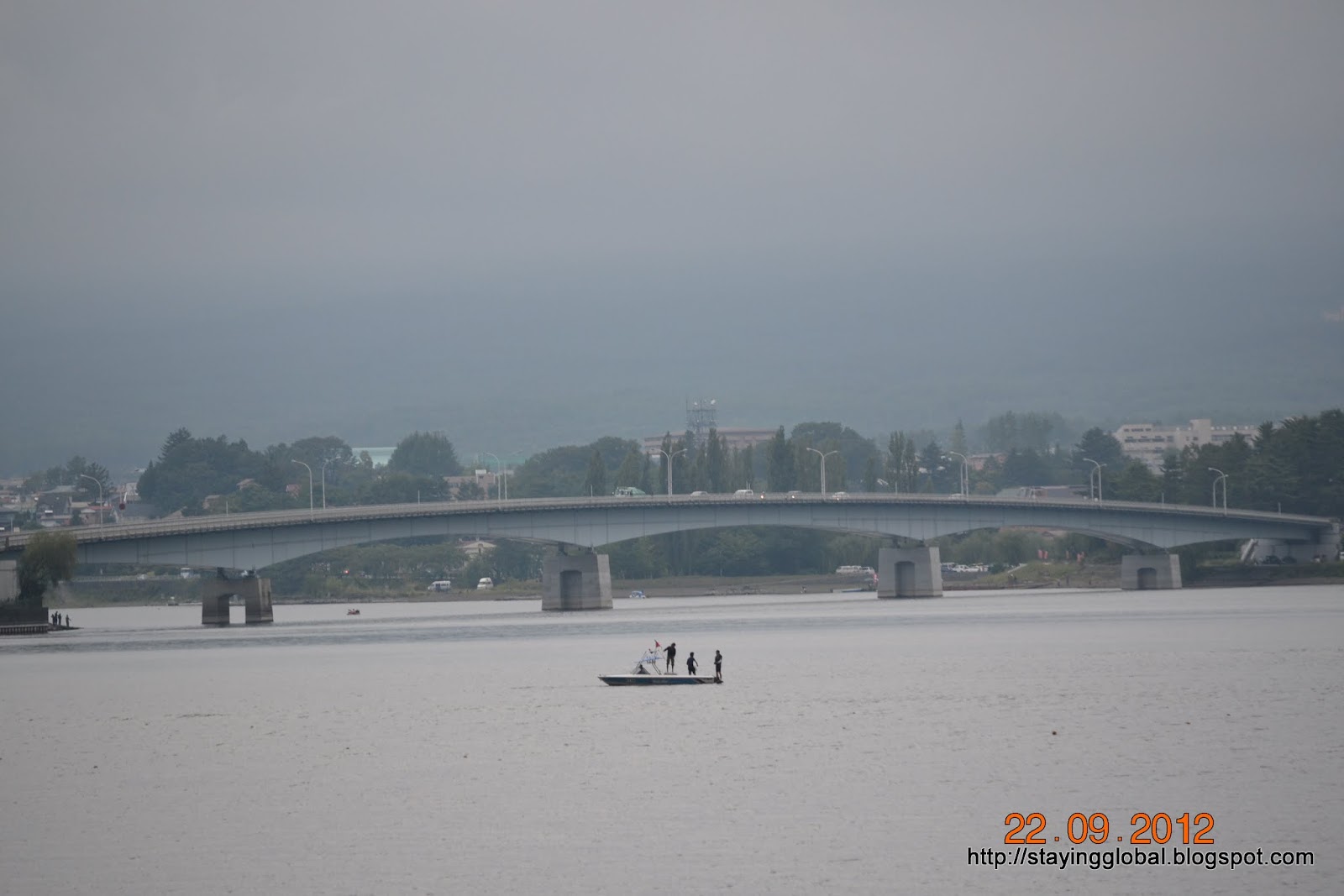
On our recent trip to the Fuji-Hakone area, we visited two of these lakes- Lake Yamanaka and Lake Kawaguchi. Our first stop was Lake Yamanaka. Yamanaka-ko as the lake is also known is the easternmost and largest of the five lakes. 
 Located at an altitude of 980 metres above sea level, it is also the third highest lake in Japan. The lake has a circumference of 13 kms and offers good views of Mt Fuji from its northern shore on clear days. 
However on the day of our visit, the sky was cloudy and as such we could not see even the slightest trace of Mt Fuji. 
Yamanaka ko is popular among visitors for Boating, fishing and other water sports and ranks as the second most developed of the five lakes behind Lake Kawaguchi.
In recent years Yamanaka ko is emerging as the most popular of the Fuji Five Lakes.

After visiting Lake Yamanaka, we drove up further to Lake Kawaguchi. On the way to Lake Kawaguchi, we briefly stopped at the Fujiyoshida Sengen shrine.

Lake Kawaguchi also known as Kawaguchi ko, is the most popular of the Fuji Five Lakes. This lake also has a circumference of 13 kms and this too offers good and unobstructed views of Mt Fuji on clear weather days and is a photographer’s delight. Most images and calendar pictures of Mt Fuji forming the backdrop of a lake are said to be taken from one of the shores of Kawaguchi-ko. 
Unfortunately we visited the lake on a cloudy day and as such we could not view Mt Fuji. Kawaguchi is the only lake amongst the Fuji Five Lakes to have an island.
 Kawaguchi ko is the most developed of the five lakes and there is no dearth of hotels and other accommodation in Kawaguchi town which has turned to a popular holiday resort.
Visitors can indulge in various water sports at Lake Kawaguchi. The Subaru toll road which leads up to Kawaguchi ko 5th Station begins from close to the Kawaguchi IC. Kawaguchiko 5th station serves as a starting point for climbing Mt Fuji.

Lake Saiko, also known as Saiko-ko is located just about 1 km to the west of Lake Kawaguchi and thus is also called the Western Lake. The western side of Lake Saiko shares its banks with the Aokigahara Jukai forest. The lake has a circumference of 10.5 kilometers but the lake is not much developed. However, there are many camp sites located along the lake’s shores.

Lake Shoji, also called Shoji-ko, is the smallest of the five lakes wth a circumference of 2.5 kms. Rocks jutting out of the lake are remnants of lava flow and these days used by locals fishing in the lake’s water. Fishing and boating are popular outdoor activities at Lake Shoji.

The last of the five lakes is Lake Motosu, which at 140 meters, is the ninth deepest lake of Japan. Motosu lake along with Lake Saiko and Lake Shoji was formed by lava flowing through the area which is now Aokigahara Jukai Forest. The lava separated a large prehistoric lake in the area thus resulting in the formation of the three lakes. These three lakes are still connected by means of underground waterways and are also said to maintain the same surface level of 900 meters above sea level. The lake has a circumference of 13 kms .The picture of Mt Fuji on the 1000 yen note is said to be a depiction of the view of Mt Fuji from near Lake Motosu. The shores are not much developed barring few camping grounds.

The Aokigahara Jukai Forest is an expansive forest south of Lake Saiko which has a network of hiking trails and is reputed to be easy to get lost in. This area is also infamous as a suicide spot. Past lava flows have also resulted in the formation of several caves around the Aokigahara Jukai Forest. Three of the lakes – Ice Cave, Wind Cave and Bat Cave have become popular tourist destinations.

The main city in the Fuji Five Lakes area is Fujiyoshida city, which is also popular for the Fuji Q Highland. Kawaguchiko area also has a variety of museums like the Yamanashi Gem museum, Kawaguchiko Music forest, Kawaguchiko Museum of Art etc. Udon noodles are a popular delicacy from the region. 

Monday, July 09, 2012

Bandai Skyline and Azuma Ko-Fuji

We visited Azuma Ko-Fuji recently. Living in Fukushima prefecture, we had visited the Bandai region quite a few times earlier. We had visited Bandai skyline and the Tsuchiyu and Takayu onsen areas on two occasions earlier, but had never been to Azuma Ko-Fuji earlier.
Mt Azuma is a collective name for various volcanoes in the Bandai Asahi National Park. Some of the well known volcanoes are Higashi- Azuma san, Issaikyo-yama, Azuma Ko-Fuji, and Nishi Azuma-san.
Azuma ko-Fuji is an active stratovolcano in the Bandai Azuma region of Fukushima prefecture. Volcanic eruptions in past has resulted in its conical shaped crater. The last known eruption  was as recent as in 1977. Its near perfect resemblance to Mt Fuji earned it the name Azuma Ko-Fuji. The fumarolic area at the base on slopes of the neighbouring Mt Issaikyo gives the entire area a sulphuric odour.
The Bandai Azuma Skyline passes from close to the base of Mt Azuma Ko-Fuji. 
This is usually a toll road, but currently there is a waiver of the toll. 
A hike of about few hundred steps lead up to the crater at an elevation of 1707 meters .
The view from atop Mt Azuma Ko-Fuji is breathtaking, we even saw a cobalt blue lake situated a little distance away and also Fukushima city in the distance. 
A small patch of the walk around the crater rim is through oddly shaped rocks.


The Jododaira visitor centre is located in the plain between Mt Issaikyo and M Azuma Ko-Fuji. 

A rest house and restaurants are also located here. Ample parking is also available here. Regular buses also ply from Fukushima station.
Bandai Azuma’s volcanic past has given it many of it’s tourist attractions including Goshikinuma, the five coloured lakes, Takayu and Tsuchiyu Onsen areas and many other natural attractions. The region is especially spectacular during Autumn when the colourful autumn foliage adds to the natural beauty. Bandai’s Skyline, Lakeline and Goldline are toll roads which are popular among tourists looking to enjoy spectacular views and the autumn foliage. During winter, the entire area is blanketed under thick snow and many areas are not accessible during this period.In winter of 2011 when we visited the Bandai Skyline area, we could only visit Takayu Onsen area. 
 Bandai area has some of the best ski resorts in the Tohoku region.

Address: Jododaira Visitor Centre, Fukushima Prefecture, JAPAN

Phone: 024-543-0986

Closing: Closed during winter: coincides with closing of Bandai Skyline

Parking: Ample Paid Parking Available.( Free as on 1st July 2012)


Monday, May 21, 2012

Zao Quasi National Park and Okama crater

After a brief visit to the Shiroishi Castle, we visited the Zao Area. Zao lies an hour's drive away from Sendai, the biggest city in northern Japan.


The Zao mountain range lies between Miyagi and Yamagata prefectures in north eastern Japan. The Zao mountain range is actually a cluster of strato-volcanoes with many active volcanic terrains. The area is part of the Zao Quasi National park and is a popular tourist destination. The park was opened in 1963 and is spread over an area of 400 square kms  filled with gorges, rivers and waterfalls, marshlands, beech forests and alpine vegetation. During winter Zao is a popular skiing destination due to the abundant snowfall in the region. Many popular skiing resorts are located in Zao area. The strong winds blowing from Siberia create Juhyo monsters, snow covered trees which resemble monsters.

The highest mountain in Zao is Mt Kumanodake (1841 meters). The central volcano of the Zao mountain range is Mt Goshikidake (1674 meters). A volcanic eruption of Goshikidake in early 18th century led to the formation of the “Okama” crater lake. 
It is called Okama owing to it’s resemblance to a tea kettle, (“okama’ in Japanese).  The lake is 200 feet deep, measures 1 km in circumference and has a diameter of 325 metres. The lake is also known as “Goshikinuma” or “Five coloured pond” because the colour of the lake changes according to the angle of sunlight.


The colour ranges from emerald green to turquoise blue depending on the weather. When we visited in early May, the lake was still frozen, but we did get to see the colour difference. 
The surrounding Mt Kattadake(1759 meters) still had some snow and we had to tread through a patch of snow to get a good view of the lake.
The volcanic mountain sides are various hues of red and brown 

The Kattamine Jinja is situated on top of Mt Kattadake which offers a commanding view of the Zao mountain range and the Okama crater. 
Another Kattamine Shrine, popularly called Shirotori Daimyojin, because of the custom of worshipping swans as the messengers of god,  is located in Miya, closer to the Shiroishi IC on Tohoku expressway.

It is possible to take a chairlift from the foot of Mt Kattadake to the top to view the Okama crater lake and the mountains. A round trip is priced at 700 yen per head. We chose to drive up to the top and skipped taking the chairlift.

The 26 km long Zao Echo line is a picturesque road which connects Miyagi and Yamagata prefectures. The road was opened in 1962 and offers good views of Zao mountain range. Driving along the Zao Echo Line visitors reach the Takimidai Waterfall Viewing Point. 


The lookout offers a good view of the Sankai waterfalls (181 meters high) and the Fudo taki waterfalls ( 53.5 meter) high.
Driving a little ahead is the Fudo taki lookout. 
A statue of Fudo stands at the entrance to the short walking trail to the lookout. The road is closed during winter. A part of the Echoline was still under snow and we drove through a few snow corridors.   

Togatta onsen town lies at the foot of the Zao. The footbath in the centre of the town is popular among visitors. The visitor information centre situated next to it has lots of booklets and guides (also in English) and the staff are helpful ( unfortunately not in English, but broken Japanese works too). "Koi no bori" (carp streamers) were strung above a river flowing through Togatta for the upcoming Kodomo no Hi. 
Zao is famous for its milk farming and while driving from Shiroishi to Zao, we passed by the Zao Milk Farm. Visitors can experience milking cows. The other famous product of Zao is its handmade sausages. Visitors can experience Sausage making for a fee . Zao’s cheese and milk treats are popular “Omiyage” (souvenirs) among visitors. Zao has it’s own version of the Kokeshi doll. We couldn’t resist picking up one.

Fees: 520 yen for a mid sized car ( Toll for Zao Echo line)

Access: Zao machi, Katta-gun, Miyagi Prefecture

Phone: 0224-34-2725 (Information centre in Togatta)